Blackpool sits on a complex foundation of glacial till and fluvioglacial sands, where drainage can shift dramatically within a few metres. The water table across the Fylde coast often lies shallow, less than 2 m below ground level in lower-lying areas, which makes accurate permeability data indispensable before designing any dewatering system or foundation drain. Many sites near the Promenade encounter layered sequences where a tight boulder clay overlies looser sand lenses; assuming a single bulk value for hydraulic conductivity leads to costly miscalculations during excavation. The Lefranc test resolves this by isolating discrete horizons in boreholes, while the Lugeon method quantifies fracture flow in the underlying Sherwood Sandstone, encountered at depth beneath the drift cover. Both procedures are run by a UKAS-accredited laboratory following BS 5930:2015 and the relevant sections of Eurocode 7 (BS EN 1997-2:2007), delivering site-specific values that feed directly into SEEP/W or PLAXIS models. When preliminary boreholes already exist, pairing the test with a grain-size analysis of retrieved samples helps validate the in situ result against Hazen or Kozeny-Carman estimates.
A single Lugeon stage in fractured Sherwood Sandstone often reveals a tenfold contrast in hydraulic conductivity between adjacent 3 m intervals—data that a simple rising-head well test cannot capture.
Our approach and scope
Local geotechnical context
The coastal climate in Blackpool accelerates a problem that drier regions rarely face: perched water tables that form during wet winters and vanish in summer, creating a false sense of ground dryness during a summer site investigation. A Lefranc test run in August might record a hydraulic conductivity an order of magnitude lower than the same horizon would show in February, simply because partial saturation alters the flow regime. The technical team therefore insists on pre-soaking each test section for at least 20 minutes in low-permeability till, and schedules critical tests during the wettest quarter whenever the construction programme allows. Another hazard along the seafront is saline intrusion: brackish pore water in the shallow sands near Central Pier affects the viscosity and density of the test fluid, so conductivity is corrected to a standard temperature of 10 °C using the ratio of dynamic viscosities. Where Lugeon testing penetrates fractured rock below the drift, high artesian pressures occasionally force a switch from open-standpipe to closed-circuit measurement, preventing uncontrolled discharge and keeping the borehole stable throughout the pressure steps.
Applicable standards
BS 5930:2015 – Code of practice for ground investigations, BS EN 1997-2:2007 – Eurocode 7: Ground investigation and testing, BS EN ISO 22282-2:2012 – Geotechnical investigation and testing: Geohydraulic testing – Part 2: Water permeability tests in a borehole using open systems
Complementary services
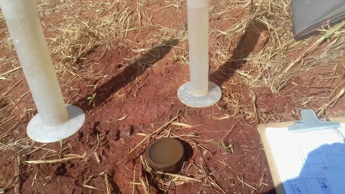
Lefranc Variable-Head Permeability Test
Designed for fine-grained soils and glacial till where low conductivity (<10⁻⁶ m/s) demands prolonged observation. A slotted standpipe is installed in a pre-bored 100 mm diameter hole, and water level recovery is tracked with an electronic dipmeter. Hvorslev shape factors are applied to convert recovery rate into hydraulic conductivity. This method works well in the boulder clay that underlies much of Blackpool's residential belt, providing design parameters for cut-off drains, soakaways, and temporary dewatering systems.
Lugeon Packer Test in Rock
Applied in boreholes that penetrate the Sherwood Sandstone aquifer beneath the drift sequence. A pneumatic double packer isolates 3–5 m stages, and water is injected at five pressure steps up to 1 MPa. Flow rate is recorded at each step, and the Lugeon coefficient (Lu) is calculated to characterise fracture conductivity and assess the need for grout curtains or pressure relief wells. This test is essential for deep basement excavations near Blackpool's seafront, where artesian conditions can develop in the sandstone.
Typical parameters
Frequently asked questions
How much does a Lefranc or Lugeon permeability test cost in Blackpool?
A single Lefranc stage in soil typically runs £450–£600, while a full five-step Lugeon test in rock falls between £650 and £870 per stage, depending on depth, access, and the number of stages required. Mobilisation to Blackpool is included for jobs lasting a full day or more. The final cost depends on how many test intervals the borehole log indicates and whether the casing is already in place.
Which test is appropriate for glacial till in Blackpool?
The Lefranc variable-head method is the standard choice for the boulder clay and laminated tills found across the Fylde. It measures hydraulic conductivity in the range typical of these soils (10⁻⁷ to 10⁻⁹ m/s) using a small-diameter standpipe and a falling-head procedure, as described in BS 5930:2015. If the till contains sand partings, a constant-head variant may be substituted to handle higher flow rates.
How long does a field permeability test take on site?
Plan on 30 to 45 minutes per test stage after the soil has saturated, plus 20–30 minutes of pre-soaking in low-permeability materials. A typical single Lefranc stage in Blackpool till is completed within 90 minutes from setup to final reading. A full five-step Lugeon test in rock takes roughly three to four hours per borehole, including packer inflation and pressure stabilisation at each increment.
What standard governs in situ permeability testing in the UK?
BS 5930:2015 is the primary code of practice for ground investigations in the UK, and Sections 25.4–25.6 cover water permeability tests. Eurocode 7 Part 2 (BS EN 1997-2:2007) provides the overarching geotechnical investigation framework, while BS EN ISO 22282-2:2012 gives specific procedures for open-system borehole permeability tests. All field work in Blackpool is conducted under these standards with UKAS-calibrated instrumentation.