BS 5930:2015+A1:2020 sets the standard for ground investigation in the UK, and when it comes to imaging what lies beneath Blackpool, seismic tomography gives us the clearest picture. The town sits on a complex mix of glacial till overlying Sherwood Sandstone and Mercia Mudstone. That geology varies sharply within just a few hundred metres. In our experience, relying solely on boreholes leaves critical gaps. Seismic refraction lets us track the top of rock and identify loose zones. Reflection profiling goes deeper, mapping faults or abandoned mine workings that are common across Lancashire’s historic industrial corridors. For projects near the seafront, we often pair a MASW survey with tomography to get shear-wave velocity profiles needed for site class determination under BS EN 1998. The saline groundwater along the Fylde coast adds another variable. Standard resistivity can drift here. Seismic velocity remains a stable, reliable parameter regardless of pore fluid conductivity, which is why we recommend it as a primary tool when planning foundations within half a mile of the Promenade. A slope stability assessment also benefits from the detailed stratigraphy that refraction tomography provides, especially where the natural slope towards the Irish Sea meets engineered fill.
Seismic velocity remains a stable parameter in Blackpool’s saline coastal groundwater, where resistivity methods lose reliability.
Our approach and scope
Local geotechnical context
The Irish Sea shapes Blackpool’s ground conditions in ways that catch out unprepared developers. Salt-laden winds and high groundwater tables accelerate weathering of the Mercia Mudstone, producing a softened zone that seismic refraction picks up as a distinct low-velocity layer. If you skip this step, a borehole log might call it rock, but the seismic data shows it behaves more like stiff soil. That discrepancy affects pile design and excavation support. Further inland, the legacy of shallow coal workings presents a different challenge. Crown holes and collapsed adits create velocity anomalies that reflection tomography can image before they become a construction problem. We have seen sites where a 10-metre-wide void sat undetected under glacial till, only visible on the reflection profile. On coastal projects, combining tomography with a liquefaction assessment clarifies whether loose saturated sands at depth pose a cyclic mobility risk under seismic loading. The Fylde coast has a low-to-moderate seismicity, but the combination of soft soils and a shallow water table still demands careful evaluation.
Video overview
Applicable standards
BS 5930:2015+A1:2020 – Code of practice for ground investigations, BS EN 1997-2:2007 (Eurocode 7) – Ground investigation and testing, BS 1377 – Standard Guide for Using the Seismic Refraction Method
Complementary services
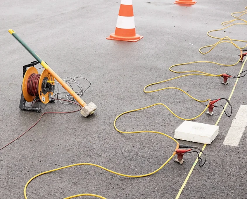
Seismic Refraction Tomography
2D P-wave velocity profiling for bedrock mapping, rippability assessment, and identifying weathered zones. We adapt geophone spacing to your site constraints, delivering interpretable sections within five working days.
Seismic Reflection Profiling
Deeper imaging for void detection, fault mapping, and stratigraphic boundaries beyond 30 metres. Useful for sites near Blackpool’s historic mining corridors and railway infrastructure.
Combined Seismic & MASW Surveys
Integrated P-wave and S-wave acquisition to determine Poisson’s ratio and dynamic elastic moduli. Required for seismic site classification per BS EN 1998 and detailed settlement analysis.
Typical parameters
Frequently asked questions
How deep can seismic refraction see in Blackpool’s geology?
With a standard sledgehammer source and a 48-channel spread, we routinely image to 25–30 metres in Blackpool’s glacial till and sandstone. Switching to an accelerated weight drop extends that to 50 metres or more, depending on site noise and the velocity contrast between layers. Reflection surveys can reach beyond 100 metres when targeting deep bedrock features or old mine workings.
How much does a seismic tomography survey cost in Blackpool?
For a typical site with a 100-metre refraction line, you are looking at a range of £2,040 to £3,610. The final figure depends on the number of lines, the required penetration depth, and the source type. We provide a fixed quote after reviewing your site location and project objectives.
Do you need both refraction and reflection for a foundation design?
Not always. Refraction alone is usually sufficient for shallow foundations and rippability. We recommend adding reflection when the desk study flags potential deep hazards, such as abandoned mine shafts, buried channels, or faults that could affect piled foundations or deep excavations.
How does saline groundwater near the coast affect the results?
It does not affect seismic velocities directly, which is one reason we prefer seismic methods over electrical resistivity along Blackpool’s seafront. Saline pore water reduces resistivity contrasts and can mask geological boundaries, but seismic P-waves travel through the saturated ground with no loss of interpretability.